Free Shipping on Orders over $100 🚚
Free Shipping on Orders over $100 🚚
Shop Clothing
Shop Footwear
Shop Hike & Camp
Shop Climbing
Accessories
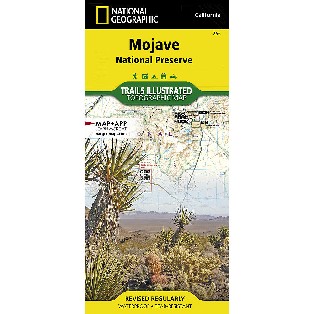
National Geographic Maps: Mojave National Preserve Map
$14.95
• Waterproof • Tear-Resistant • Topographic Map
Located at the confluence of the Mojave, Sonoran, and Great Basin desert regions, Mojave National Preserve is one of the most diverse desert environments in the world. Explore the Joshua Tree forests, sand dunes, volcanic cinder cones, mile-high mountains, and vast vistas of this unique region with National Geographic's Trails Illustrated map of Mojave National Preserve. Created in partnership with local land management agencies, this expertly researched map features key areas of interest including Kelso Depot, Hole-in-the-Wall, Mitchell Caverns, Rock Springs, Clark Mountain, Cinder Cone Lava Beds, and the historic Mojave Road.
Designed with a wide range of visitors in mind, this map features detailed and easy-to-read trails, accurate road network, safety tips, and contact information for local agencies. A handy summary of over twenty points of interest will help you plan your visit. Park regulations and base temperature charts for Soda Springs and Granite Mountains are also included. Recreation features and amenities are clearly marked, including campgrounds, trailheads, interpretive trails, ranger stations, gas stations, lodging, and food services. The map base includes contour lines and elevations for summits.
Every Trails Illustrated map is printed on "Backcountry Tough" waterproof, tear-resistant paper. A full UTM grid is printed on the map to aid with GPS navigation.
Other features found on this map include: Bristol Mountains, Clark Mountain, Devils Playground, Granite Mountains, Ivanpah Lake, Mojave Desert, Mojave National Preserve, Mojave River, Providence Mountains, Shadow Valley, Silver Lake, Soda Lake.
You may also like
Recently viewed products
Subscribe
Sign up to get the latest on sales, new releases and more …